
When technology fails, your skills count. A compass doesn't need a battery, a map doesn't need a network - together they get you safely to your destination, no matter where you are.Whether you're on a trekking tour, a bushcraft adventure or a weekend hike: if you know how a compass and map work, you can stay independent and find your way even in unfamiliar terrain. In this guide, you will learn how to find your way safely using simple means - step by step, clearly explained and immediately applicable outdoors.
Table of contents
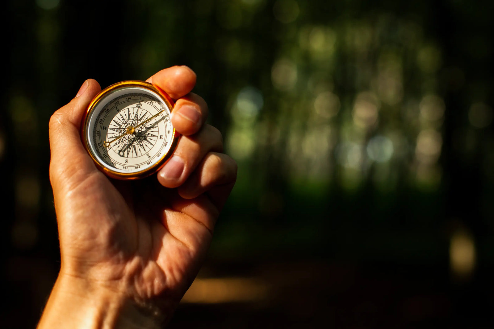
How does a compass work and why is it essential for navigation?
What types of compasses are there and how do I choose the right one?
What steps do I need to take to use a compass correctly?
How do I read a topographical map correctly and recognize important symbols?
How do I use the compass and map together for perfect navigation?
How do I recognize the direction of the compass and determine my course?
What role does magnetic deviation play in navigation?
What is the best way to learn orientation in the terrain?
Summary
How does a compass work and why is it essential for navigation?
At first glance, a compass looks simple - and that is precisely its strength. No electronics, no app, no screen. Just a magnetic needle that shows you where north is. And it doesn't do this by chance, but because it aligns itself with the earth's magnetic field - and always in the direction of the magnetic north pole.
The principle: Why does the needle point north?
Inside the compass is a magnetized needle that can rotate freely. This so-called compass needle aligns itself with the earth's magnetic field - just as the first explorers and sailors used to do. The tip of the needle always points to the magnetic north pole - not the geographic one, but more on that later.
This means that if you hold the compass horizontally and steady, you can use the needle to find your bearings and determine the cardinal points at any time - no matter where you are.
The structure of a compass - briefly explained
A typical hiking or map compass consists of several components:
-
Compass needle: Usually colored red at the northern tip, magnetically mounted.
-
Rotating ring with scale: Divided into 360 degrees, for determining direction.
-
Orientation arrow: Points forwards, i.e. in the desired direction of travel.
-
Housing with liquid: Dampens the needle movement for accurate reading.
- (For map compasses): Transparent base plate with scale and ruler for map work.
Depending on the model, additional features such as a mirror, magnifying glass or luminous markings are added - but the basic principle always remains the same.
Magnetic north vs. true north
Important to know: The compass needle does not point exactly to the geographic North Pole, but to the magnetic North Pole, which is slightly offset. This deviation is called magnetic declination - and it differs depending on where you are in the world. For simple hikes in Central Europe, you can usually ignore this difference. However, if you are navigating precisely or are traveling in unfamiliar terrain, you should know the declination and compensate for it (more on this further down in the article).
Why the compass remains an indispensable tool
Even though GPS, smartphone apps and digital maps are available today: The compass has one decisive advantage - it always works. No batteries, no malfunctions, no updates necessary. It is robust, lightweight and immediately ready for use.
The compass is a reliable companion, especially if you are going on longer tours in remote areas or simply want to be independent of technology. And in combination with a map, you have a precise and safe navigation system that you can rely on - no matter how rough the terrain is.

What types of compasses are there and how do I choose the right one?
Not all compasses are the same. Depending on what you intend to do - leisurely hiking, taking precise bearings or relying on seconds when orienteering - there are different models, each with their own strengths. Here you can get an overview of which type of compass suits your purpose and what you should look out for when buying one.
Plate compass - the classic for hikers
The plate compass, also known as a map compass or basic compass, is your ideal companion if you work a lot with a map. It consists of a rotating compass housing that is attached to a transparent base plate. You will often find a ruler, various scale bars and a bearing aid on it.
Its advantage: you can place it directly on the map, align the direction arrow and determine your exact direction of travel. The plate compass is the perfect choice for hiking, trekking tours or bushcraft adventures - functional, robust and easy to use.
Mirror compass - for precise navigation and direction finding
If you are often out and about in challenging terrain or want to take particularly precise bearings over long distances, a mirror compass is the right choice. As the name suggests, it has an integrated mirror that allows you to look at the compass needle and a target in the distance at the same time.
This sounds like a detail, but in practice it makes all the difference: you can read directions much more accurately and align your course to a target far ahead. This is a real advantage, especially on expeditions, in the mountains or on wilderness tours.
Thumb compass - for quick orientation on the move
The thumb compass is specially designed for orienteering runners or mountain bikers. It is worn on the thumb and enables quick changes of direction when running - ideal for competitions or fast navigation in the terrain.
You don't need it for classic hikes - but it's good to know that it's available if you want to combine speed with accuracy.
Apopular example is the Suunto compass, which is known among outdoor enthusiasts for its durability and precision.

What steps are necessary to use the compass correctly?
Holding a compass in your hand is one thing - using it correctly is another. So that you not only know the cardinal points on your tour, but also walk safely in the desired direction, I will show you step by step how to use your compass correctly.
1. keep the compass level
Very simple, but essential: always hold your compass horizontally and steady in front of you, ideally at chest height. This allows the compass needle to move freely and align itself correctly with the earth's magnetic field. A tilted position or movement distorts the display - this basic rule is particularly important in terrain with many differences in altitude.
2. align the direction arrow with the target
Imagine you want to get to a specific point in the landscape: a summit, a hut or a lake. Now point the direction arrow of the compass directly at this target while holding the compass horizontally. Turn your body until the arrow points exactly in the direction of your target.
3. adjust the rotating ring so that the needle and the north mark coincide
Now carefully turn the scale ring (also known as the compass housing) until the north point of the compass needle is exactly in line with the north mark in the housing. Some people also call this "bringing the needle into the house" - in other words, the red tip of the needle lies exactly in the north field of the scale.
From now on, the direction arrow will reliably show you in which direction you need to walk. All you have to do is make sure that the needle and housing continue to match - then you will stay on course.
4. use the orientation arrow as a direction of travel
As soon as your compass is set, you can set off. The orientation arrow (often a small arrow on the base plate) now shows you the direction of travel. Choose prominent points along this course, e.g. a tree, stone or rocky outcrop, and head for them. This way you don't have to keep looking at the compass, but can orientate yourself visually.
5 Avoid common mistakes
To prevent you from accidentally heading in the wrong direction, here are a few typical pitfalls - and how to avoid them:
-
Tilt the compass or hold it at an angle → Needle may not align correctly
-
Magnetic sources of interference (e.g. smartphone, metal, power bank) → Always keep some distance away
-
Read the needle with the wrong end → Only the northern tip counts (often marked red)
- Use the compass on an uneven or moving surface → always choose a stable, flat surface, e.g. the flat of your hand
If you internalize these steps, using the compass will quickly become routine - and you will always have an overview, even in unfamiliar terrain.

How do I read a topographical map correctly and recognize important symbols?
A topographical map is more than just paper with lines and colors - it is your bird's eye view of the terrain. If you know how to read the map, you can recognize paths, heights, valleys, bodies of water and much more. It shows you where you are - and where you want to go. Here you will learn what really matters when reading maps.
Scale, legend & coordinates - the basics
The scale shows you how big the map is compared to reality. For example, a scale of 1:25,000 means: 1 cm on the map corresponds to 250 m in nature. The smaller the number, the more detail you can see - ideal for hiking or trekking tours.
The legend explains all the symbols on the map - types of paths, contour lines, buildings, vegetation, bodies of water. It is usually printed on the edge of the map. Always take some time to study it the first time you read it.
The coordinate system helps you to determine your exact location - especially if you use GPS and map together. Coordinates indicate the geographical position in degrees of longitude and latitude (e.g. for triangulation or to determine your location).
Contour lines - understanding the terrain
The so-called contour lines show you how hilly or steep an area is. They always run at a constant height - for example, every 10 or 20 meters. The closer together the lines are, the steeper the terrain is. Lines that are far apart indicate flat sections.
A few examples for interpretation:
-
Rounded lines that become narrower → a mountain or hill
-
Lines that run like a funnel → a valley or depression
- Bends in contour lines → signs of rocks, drop-offs or changes in terrain
If you have learned to "read" contour lines, you will get an amazingly accurate picture of the terrain - even before you set foot on it.
Recognize important map symbols
Every topographical map uses a variety of standardized symbols that provide you with important information:
-
Thick lines: Main paths, roads
-
Dashed lines: Hiking trails, footpaths
-
Blue lines and areas: Streams, rivers, lakes
-
Green areas: Forests, scrubland
-
Black rectangles: buildings, huts, viewpoints
- Crosses or dots: Signposts, markers or summit points
If you work with the map regularly, you will quickly memorize the symbols - and you will become increasingly confident in grasping them at a glance.
Estimate distances correctly
Distances on the map can be easily measured using a ruler or the scale bar. Make sure that you transfer the lines realistically - e.g. include serpentines or winding paths. Straight lines rarely work in nature.
Many maps have additional aids such as grids or distance scales at the edge of the map - these help you to better estimate distances or walking times.

How do I use a compass and map together for perfect navigation?
When you combine compass and map, you create an unbeatable team that guides you precisely through the terrain. This allows you to make optimum use of both tools:
1. align the map to the north
Lay your map on a flat surface and place the compass on top of it so that the north-south lines of the map are parallel to the orientation arrow. Now rotate the entire ensemble (map + compass) until the magnetic needle is exactly in the north field of the compass housing. Your map is now oriented north - terrain features match reality.
2. determine the location (triangulation)
Find two or three prominent points on the map that you can see clearly in the landscape (e.g. summit, transmission mast, building). Align the compass with the direction arrow to one of these points and read the bearing (degrees) from the scale ring. Transfer this bearing as a line (bearing line) on your map: Place the edge of the compass on the known point and draw a line in the direction of the angle. Repeat this for the second point. Where the two lines cross is where you are - your exact location on the map.
3. set course
Once you have your location, connect it to your next target point on the map. Place the compass along this line, making sure that the compass blade (orientation arrow) points in the direction of your destination. Now turn the compass housing until the needle is in the north field. The direction arrow now shows you the exact direction of travel. Make a note of the degree value (e.g. 045°) and keep taking bearings in the terrain at intervals of 50 m or until the next prominent object.

How do I recognize the compass direction and determine my course?
Knowing the cardinal points is the first step towards orientation. But to really stay on course, you need something more: an understanding of angles, the 360-degree system and a reliable bearing. Don't worry - it sounds more complicated than it is. Here you can find out how to reliably determine your route in just a few steps.
Understanding the 360-degree system
A compass is divided into 360 degrees - a complete circle. North is at 0° or 360°, east at 90°, south at 180° and west at 270°.
With this division, you can put every direction into numbers - and thus run exact courses instead of just roughly navigating "left" or "straight ahead".
This is particularly helpful when you are in unfamiliar terrain or cannot recognize terrain features in fog and poor visibility.
Take a bearing: How to determine your destination
Do you want to get to a point in the landscape - such as a hut, a rock or a prominent tree - and want to determine the exact direction to get there? Then taking bearings is the method of choice:
-
Hold the compass horizontally in front of you and align the direction arrow with your target.
-
Turn the rotating ring until the north point of the needle coincides with the north mark ("north house") in the housing.
-
Read offthe degree value at the end of the direction arrow - this is your direction of travel.
Now you can transfer the direction on the map or simply start walking as long as you keep the needle in the "north house" and keep an eye on the direction arrow.
Bearing back: where you came from
It's not just the "where to" that counts, but also the "where from". With a bearing back, you can see which direction you came from - helpful for route planning or checking your location:
- Hold the compass with the arrow pointing in the opposite direction to the direction of travel.
- Turn the scale ring again so that the needle is in the north field.
- The direction arrow now shows the course you have traveled.
You can also use this method to reconstruct your way back - for example, if the weather suddenly changes or if you are looking for an alternative way back.
Particularly practical: Some compasses have a visual bearing aid or luminous markings that help you to keep your direction even at dusk or at night.
What role does magnetic deviation play in navigation?
If you are working with a map and compass, it can happen that your compass does not point exactly in the direction you should be going according to the map. The reason for this is magnetic deviation, also known as declination. It describes the angular difference between magnetic north (which your compass shows) and true north (which is shown on maps).
What is magnetic declination?
The earth has two "north":
- The geographic North Pole, which is the northernmost point of the Earth's axis.
- The magnetic north pole, to which the compass needle is aligned - and which is offset depending on the region.
The difference between the two is called declination. Depending on the location, this deviation can be several degrees - and also changes over the years, as the magnetic north pole slowly shifts.
In Germany, the deviation is currently (as of 2025) around 2-3 degrees east - in other words, magnetic north is to the east of geographic north.
Finding declination values
How do you know how big the deviation is in your area? There are several ways to do this:
- On many topographical maps, the declination is already noted on the edge of the map.
- You can find current values online using services such as the NOAA Magnetic Field Calculator or map apps with a declination display.
- Special outdoor navigation devices also show you this value - often with automatic correction.
How to compensate for the deviation
If you want to navigate precisely, you should take the declination into account when using the compass. The correction works like this:
-
Declination to the east (as in Central Europe): Subtract the declination value from the course you measured on the map.
- Declination to the west: Add the value to the course.
Example:
You measure a course of 100° on the map, the declination is +3° east.
You are then running a course of 97° with the compass.
Some high-quality compasses have an adjustable declination compensation directly on the housing - this automatically takes the correction angle into account.

What is the best way to learn orientation in the terrain?
Knowing the theory is one thing - mastering it in practice is another. Orientation in the terrain is like riding a bike: It takes practice before it becomes second nature. Here I'll show you how to systematically learn how to find your way safely - from reading your first compass to navigating with confidence, even in unfamiliar terrain.
Practice makes perfect - how to train systematically
The best way to learn orientation is to practise gradually and regularly. Start in familiar terrain - for example, in your local park or on a familiar hiking route. There you know the surroundings and can compare your measurements and bearings with reality.
Level 1: Consolidate the basics Take your compass and map with you on your next hike and practise the basics: align the map to the north, determine your location, take simple bearings. Even if you know the way, this will help you get used to using the tools.
Stage 2: Venture into unknown terrain As soon as you feel confident, choose new routes. Plan your route in advance at home using a map and then follow your planned route using only a compass and map - without GPS as your main navigation tool.
Level 3: Increase challenges Test your skills in poorer conditions: Fog, twilight or dense forest. This will show you whether you can really navigate or whether you are just using terrain features as a guide.
A sensible combination with GPS as a backup
Even if the compass is the more reliable tool, a GPS device or smartphone app can be a useful addition - but only as a backup, not as the main navigation tool.
Use GPS to check and calibrate your compass readings. This will also teach you where your weaknesses lie and how accurately you can work with traditional methods. On longer tours or in difficult terrain, a GPS device is a useful emergency aid.
Important: Never rely solely on technology. Batteries can run out, devices can break - compass and map always work.

Summary
Compass and map are timeless tools that help you to navigate independently and safely through any terrain. While GPS and smartphone apps are practical, they can fail - a compass does not.
The most important points at a glance:
Master compass basics: Understand how the magnetic needle works and learn to read the compass correctly. The 360-degree system and correct posture are the basis for everything else.
Develop map skills: Read topographical maps, interpret symbols and determine distances correctly. Contour lines show you the terrain before you set foot on it.
Perfect the combination: Using compass and map together for precise location and navigation. Triangulation and setting courses are your most important tools.
Take magnetic deviation into account: Include declination in calculations for maximum accuracy - especially important on longer trips or in other countries.
Practise regularly: consolidate your orienteering skills through practical exercises in different types of terrain. Only through repetition will navigation become routine.
Pay attention to safety: Always master several orientation methods and navigate with particular care in uncertain weather conditions. Weather and orientation go hand in hand - learn to interpret weather signs correctly to stay safe on the move.
Orientation with a compass and map is a skill that gives you self-confidence and independence in the great outdoors. Whether hiking, trekking or bushcraft - if you know your bearings, you are never really lost. Start small, practise regularly and you will soon notice: Nature will become your familiar terrain, no matter where you are.